Environmental Economic Analysis and Infrastructure Policy in Uganda
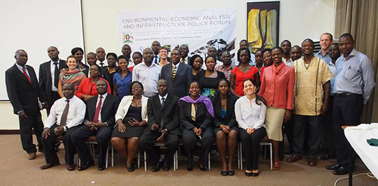 Participants of the 2014 Forum
The Environmental-Economic Analysis and Infrastructure Policy Forum: Integrating ecosystem conservation and infrastructure development for social and environmental well-being in Uganda was held on September 10-11, 2014 in Kampala, Uganda in partnership with the Uganda National Environmental Management Authority (NEMA). Over 50 people attended from government, private sector and civil society organizations throughout the country. The objective of the forum was to share and discuss environmental-economics and policy tools for integrating biodiversity conservation into infrastructure development in Uganda. The forum was part of CSF’s four-year Biodiversity Understanding in Landscape Development (BUILD) program made possible by the support of the American People through the United States Agency for International Development (USAID).
The forum consisted of an infrastructure clinic on environmental-economic tools, which included presentations of CSF case studies for integrating biodiversity into infrastructure planning and development around the world, sessions showcasing three Ugandan analysis projects being led by CSF course graduates, and a presentation on the potential of biodiversity offset mechanisms to compensate and mitigate environmental degradation. The policy sessions presented an overview of infrastructure development plans in Uganda, the results of CSF’s global review of infrastructure policy best practices with the Environmental Law Alliance Worldwide (ELAW), and potential policy innovations to integrate biodiversity conservation into infrastructure development in Uganda. The event concluded with the launch of the new NEMA document: Guidelines for Conducting Economic Analysis of Environmental Impacts in Uganda, developed with CSF technical support.
 Sunrise in Uganda
The forum generated excellent discussions, and provided a valuable opportunity to showcase the goals, methods and results of the three follow-up field research projects with course graduates from our 2012 Uganda course that analyze the environmental-economic impacts of specific infrastructure threats to biodiversity in the Albertine Rift region of Uganda.
• The International Gorilla Conservation Programme (IGCP) analysis project evaluated the economic and environmental impacts of upgrading a road that crosses the Bwindi Impenetrable Forest National Park, home to half the world’s endangered mountain gorillas. The analysis compared a road going through the park to alternative road options that would not cross the park but would serve communities currently lacking road access. The results of the study show that the road alternatives outside the park would not only safeguard gorilla populations, but would actually have a better overall economic performance because they would reach more communities and would maintain lucrative gorilla tourism revenues.
• The Wildlife Conservation Society (WCS) Uganda project applied an innovative GIS methodology to determine the least environmentally risky route for a proposed oil pipeline that will run from Murchison Falls National Park to a refinery in neighboring Hoima district. Findings suggest that this methodology offers significant scope for reducing environmental impacts of linear infrastructure such as roads and pipelines by systematically including information on conservation values when analyzing potential routes.
• The National Environmental Management Authority (NEMA) and Ugandan Wildlife Authority (UWA) analysis project aimed to identify and quantify the impacts on biodiversity from the planned oil pipeline development in Murchison Falls National Park. Methodology and preliminary results were presented at the forum with emphasis on the innovative GIS spatial methodology, approach and process. Policy forum participants endorsed the methodology and requested further communications so that results can be used to inform upcoming plans and decisions. Important outcomes of the study include building additional GIS analytical capacity for the NEMA and UWA staff involved in the project, and creating awareness at an institutional and national level of these spatial economic analysis tools for integrating biodiversity into infrastructure planning.
After the forum presentation, Petroleum Exploration and Production Department (PEPD) representatives showed interest in the Murchison Falls pipeline studies, and expressed openness to the idea of using the methodologies to improve pipeline routing, demonstrating that this type of analysis can have a direct impact on infrastructure decision making. Similarly, throughout the Bwindi road analysis project, IGCP has held meetings and discussions with the Uganda National Road Authority, Uganda Wildlife Authority, and Uganda Chapter of Poverty and Conservation Learning Group. CSF and our partners continue to support these projects and the dissemination of their results to key stakeholders in Uganda and around the world.
- Log in to post comments