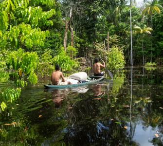
In partnership with Instituto Socioambiental (ISA) and Rede Xingu+, Conservation Strategy Fund (CSF) Brazil developed an Indigenous Land (IL) Management Calculator to predict budget levels for different management activities of about 20 Indigenous Lands located in the Xingu River region.
Nearly all of Brazil’s ILs are located in the legal Amazon region. According to recent research, forest loss in the Brazilian Amazon is 17 times lower in ILs than in unprotected areas. Assurance of Indigenous Peoples' right to the land not only fosters conservation, but secures a native communitie’s ability to live and thrive in their ancestral territories with dignity and safety. However, there are still many Indigenous communities that live in unprotected areas in Brazil, and the advance of the agricultural frontier is a persistent threat to their survival.
There are 731 recognized ILs within Brazil today accounting for about 13% of the national territory. Within these areas, communities make decisions and manage their lands through Territorial and Environmental Management Plans for Indigenous Lands (or PGTAs for their acronym in Portuguese).
PGTAs are created by the Indigenous Peoples and serve as a register of how the territories are managed for cultural, environmental, and economic purposes, and outlines goals for improvement. In general, PGTAs are developed around themes such as territorial protection, governance, and sustainable use of natural resources, but they can also reflect the individualities of each Indigenous community. These documents are important as they promote dialogue among Indigenous Peoples, the government, and Indigenous organizations. They are also an important tool to advocate for public policies that address Indigenous peoples needs appropriately and secure financial resources for community implementation.
With the low budget distributed to ILs management, the federal and local government alone does not provide enough financial support to build or improve the infrastructure and objectives established by the PGTAs. Many NGOs and international organizations are working to address this budget shortfall, in order to support the PGTAs goals.
In partnership with ISA and Rede Xingu+, Conservation Strategy Fund (CSF) Brazil developed a general cost model based on historical and hypothetical data that is able to predict budget levels for different management activities of about 20 Indigenous Lands located in the Xingu River region.
The cost model predicts values for improvements in eight strategic areas included in the majority of the PGTAs in the region: governance; inspection and protection; cultural strengthening; income generation; food sovereignty; infrastructure (energy, communication and transport); education; health and sanitation. In addition to presenting the costs involved in achieving these improvements, our results show how much, according to these priority areas, the PGTAs are already implemented – varying by degrees from “not implemented” to “well implemented”.
We builded a website to host the cost model with explanatory visual elements which facilitate access to and use of the cost model by all stakeholders. This online “calculator” of the values of these eight strategic areas is similar to CSF’s Mining Impacts Calculator, and is able to be used by NGOs and Indigenous organizations as an important resource for raising funds for native communities, but also as a tool for monitoring the implementation of its management goals.
According to André Villas Bôas (ISA/Rede Xingu +):
Xingu's protected areas are a valuable socio-environmental heritage and are increasingly under threat. Managing these areas is complex, and this calculator is the first tool to present the real minimum costs for their protection.
Since its launch, the Indigenous Land Management Costs Calculator has been adopted by indigenous organizations in the Xingu region, assisting them in accurately estimating financial needs and securing funding for PGTA initiatives.
In the future, this tool can be adapted for other regions outside the Xingu area and can be used in strategic planning for the management and protection of ILs in Brazil. By improving the management of these areas, our goal is to contribute to the overall conservation of the Amazon rainforest and the sovereignty of the communities stewarding their ancestral land.
Go to our calculators hub and discover all CSF's free tools to support decision-making.
Photo credit: Shutterstock.com