


In this analysis, we assess the effect of Madeira River energy and transportation infrastructure projects on soybean expansion. Precarious transportation networks and natural barriers have kept the region of the Upper Madeira River geographically and economically isolated and have contributed to the low population densities, particularly in the Bolivian States of Beni and Pando. The development potential of this area, where Brazil, Peru and Bolivia meet, lies in the possibilities of accessing the Atlantic and Pacific Oceans by river or through the construction and pavement of roads.
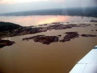
There are currently a number of energy and transportation projects aimed at promoting physical integration of Peru, Brazil and Bolivia’s Amazon territories. The Madeira River Hydroelectric and Navigation Mega-project includes the construction of two hydroelectric power stations (HPS) – Jirau and Santo Antonio – in Brazilian territory, a third hydroelectric power station between Abunã (Brazil) and Guayaramerín (Bolivia), and probably a fourth in the Esperanza waterfall on the Beni River in Bolivian territory. This project also includes the construction of locks and electricity transmission lines. According to the project’s promoters, these investments would generate energy at competitive prices and would allow the navigation of more than 4,000 km of waterways, currently impeded by the existence of waterfalls and rapids in the Upper Madeira River. Another transportation infrastructure project planned in the Bolivia, Brazil and Peru tri-border area is the pavement of the Northern Corridor connecting La Paz, Guayaramerín and Cobija in Bolivia.
This study predicts potential land use changes as a function of soybean expansion that would could occur in the regions of Brazil, Bolivia, and Peru affected by the future implementation of Madeira’s energy and transportation infrastructure projects. To assess the effect of infrastructure’s mega-projects on soybean transportation costs, we simulate: 1) the building of the hydroelectric power stations Jirau and Santo Antônio (Brazil), Abunã-Guayaramerín (Brazil-Bolivia), and Esperanza (Bolivia) and; 2) the paving of the Northern Corridor (Bolivia), the Cuiabá-Santarém Corridor (Brazil), and the Transoceanic Highway (Brazil-Peru). The simulations are based on 12 alternative infrastructure scenarios.
We use an interdisciplinary model to estimate soybean yields based on climatic, edaphic, and economic determinants. Afterwards, we use soybean yield predictions to estimate a soybean rent surface. The effect of new energy and transportation infrastructure projects will be specifically addressed by estimating the cost of shipping soybeans to the nearest export port under each proposed scenario, using spatial analysis techniques. These approaches will allow us to assess spatial variations in the economic viability of soybean production and the degree to which expanded plantings can be influenced by the future bi-national infrastructure investments.
-Click here to read a full-length report on transportation projects and soybean expansion in the Madeira River Basin that came as a result of this project.